Montague Township sits at the high point of New Jersey, cradled by the Delaware River and the Kittatinny Mountains, where New Jersey, New York, and Pennsylvania converge. The Dutch initially settled in the Minisink Valley and helped define the character of the area. Founded in 1759, the township evolved along the river, which encouraged trade and travel, and on the legendary Old Mine Road, a Native American trail and trade route. By 1826, the Milford Bridge was built and would serve as a gateway to the Poconos. Following the Civil War, farms dotted the landscape, and city residents escaped the... Read More
Format: Paperback
🚛 Ground shipping arrival between Wednesday, February 26 and Tuesday, March 04.
Free returns. Free Economy shipping on orders $50+.
Montague Township sits at the high point of New Jersey, cradled by the Delaware River and the Kittatinny Mountains, where New Jersey, New York, and Pennsylvania converge. The Dutch initially settled in the Minisink Valley and helped define the character of the area. Founded in 1759, the township evolved along the river, which encouraged trade and travel, and on the legendary Old Mine Road, a Native American trail and trade route. By 1826, the Milford Bridge was built and would serve as a gateway to the Poconos. Following the Civil War, farms dotted the landscape, and city residents escaped the... Read More
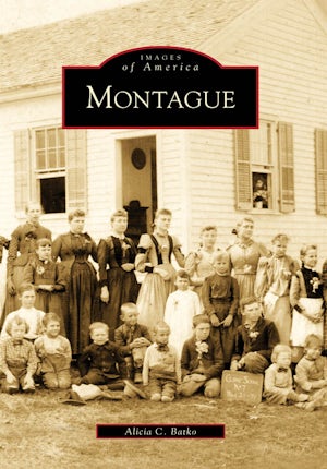
Montague Township sits at the high point of New Jersey, cradled by the Delaware River and the Kittatinny Mountains, where New Jersey, New York, and Pennsylvania converge. The Dutch initially settled in the Minisink Valley and helped define the character of the area. Founded in 1759, the township evolved along the river, which encouraged trade and travel, and on the legendary Old Mine Road, a Native American trail and trade route. By 1826, the Milford Bridge was built and would serve as a gateway to the Poconos. Following the Civil War, farms dotted the landscape, and city residents escaped the industrial boom by frequenting the Brick House and Rock View hotels and neighboring summer boarding homes. The range of vistas served as inspiration for John Newton Howitt and other artists. With progress and infrastructure heralding change, High Point State Park and Delaware Water Gap National Recreation Area were formed to protect natural resources, yet historic structures within them vanished.
Details
Pages: 128
Publisher: Arcadia Publishing Inc.
Imprint: Arcadia Publishing
Series: Images of America
Publication Date: 18th May 2009
State: New Jersey
Illustration Note: Black and White
ISBN: 9780738564548
Format: Paperback
BISACs: PHOTOGRAPHY / Subjects & Themes / Historical TRAVEL / Pictorials (see also PHOTOGRAPHY / Subjects & Themes / Regional) PHOTOGRAPHY / Subjects & Themes / Regional (see also TRAVEL / Pictorials) HISTORY / United States / State & Local / Middle Atlantic (DC, DE, MD, NJ, NY, PA)
Reviews
Title: GLS Reivews Author: Gordon Bond Publisher: Garden State Legacy Date: September 2009
The sepia tone colored covers of the ubiquitous Arcadia Press "Images of America" series have come to dominate the shelves of bookstore and library New Jersey sections.
Inexpensive and chock full of neat old pictures, they've promoted interest by residents in the history of their town and given local historians an opportunity to be published.
Among their latest offerings in New Jersey is Alicia C. Batko's "Montague," covering the northernmost Township in the state. It begins--as all good New Jersey histories must--with the original Lenape natives, but also the interesting geology and geography of the Kittatinny Mountains and High Point.
A representation of late 17th century maps show how the border between New Jersey and New York was different back then. The flat line that runs northwest along the top extended further up into what is today New York State, giving New Jersey the appearance of having a feather in its cap heading off to the left! There are also pictures of the 1882 Tri-State Rock where New Jersey, New York and Pennsylvania meet as well as a New Jersey boundary monument that is, technically, 72.25 feet north of the actual border into New York! The area was part of the long-running dispute over where the exact border really is.
There was a strong Dutch presence from the early days of Montague and the proximity to the Delaware River supported cabled ferries and grist mills. When later "modern" bridges were built, the old rafts were pressed into service whenever they were damaged by floods or ice.
Like most Arcadia books, this one features a wonderful collection of vintage photos highlighting Montague's buildings and people. Vistas of the nearby Poconos inspired artists and were enjoyed by vacationing citydwellers who frequented the hotels and boarding houses. But the place never gave up its rural charm, even managing to avoid the 1967 proposal for a Tock's Island Dam and Reservoir.
Batko was born in Brooklyn, NY, but has lived in Montague since 1981 where she has been active with the Montague Association for Restoration of Community History--a.k.a. MARCH--and serves on the Board of Directors for the Minisink Valley Historical Society and township historian.
Author Bio
Alicia C. Batko is the historian for the Montague Association for Restoration of Community History and the township historian. Through collaboration and archival research, she has compiled rare photographs and historical information to present an unprecedented overview of Montague's landscape and heritage.
Montague Township sits at the high point of New Jersey, cradled by the Delaware River and the Kittatinny Mountains, where New Jersey, New York, and Pennsylvania converge. The Dutch initially settled in the Minisink Valley and helped define the character of the area. Founded in 1759, the township evolved along the river, which encouraged trade and travel, and on the legendary Old Mine Road, a Native American trail and trade route. By 1826, the Milford Bridge was built and would serve as a gateway to the Poconos. Following the Civil War, farms dotted the landscape, and city residents escaped the industrial boom by frequenting the Brick House and Rock View hotels and neighboring summer boarding homes. The range of vistas served as inspiration for John Newton Howitt and other artists. With progress and infrastructure heralding change, High Point State Park and Delaware Water Gap National Recreation Area were formed to protect natural resources, yet historic structures within them vanished.
Pages: 128
Publisher: Arcadia Publishing Inc.
Imprint: Arcadia Publishing
Series: Images of America
Publication Date: 18th May 2009
State: New Jersey
Illustrations Note: Black and White
ISBN: 9780738564548
Format: Paperback
BISACs: PHOTOGRAPHY / Subjects & Themes / Historical TRAVEL / Pictorials (see also PHOTOGRAPHY / Subjects & Themes / Regional) PHOTOGRAPHY / Subjects & Themes / Regional (see also TRAVEL / Pictorials) HISTORY / United States / State & Local / Middle Atlantic (DC, DE, MD, NJ, NY, PA)
Title: GLS Reivews Author: Gordon Bond Publisher: Garden State Legacy Date: September 2009
The sepia tone colored covers of the ubiquitous Arcadia Press "Images of America" series have come to dominate the shelves of bookstore and library New Jersey sections.
Inexpensive and chock full of neat old pictures, they've promoted interest by residents in the history of their town and given local historians an opportunity to be published.
Among their latest offerings in New Jersey is Alicia C. Batko's "Montague," covering the northernmost Township in the state. It begins--as all good New Jersey histories must--with the original Lenape natives, but also the interesting geology and geography of the Kittatinny Mountains and High Point.
A representation of late 17th century maps show how the border between New Jersey and New York was different back then. The flat line that runs northwest along the top extended further up into what is today New York State, giving New Jersey the appearance of having a feather in its cap heading off to the left! There are also pictures of the 1882 Tri-State Rock where New Jersey, New York and Pennsylvania meet as well as a New Jersey boundary monument that is, technically, 72.25 feet north of the actual border into New York! The area was part of the long-running dispute over where the exact border really is.
There was a strong Dutch presence from the early days of Montague and the proximity to the Delaware River supported cabled ferries and grist mills. When later "modern" bridges were built, the old rafts were pressed into service whenever they were damaged by floods or ice.
Like most Arcadia books, this one features a wonderful collection of vintage photos highlighting Montague's buildings and people. Vistas of the nearby Poconos inspired artists and were enjoyed by vacationing citydwellers who frequented the hotels and boarding houses. But the place never gave up its rural charm, even managing to avoid the 1967 proposal for a Tock's Island Dam and Reservoir.
Batko was born in Brooklyn, NY, but has lived in Montague since 1981 where she has been active with the Montague Association for Restoration of Community History--a.k.a. MARCH--and serves on the Board of Directors for the Minisink Valley Historical Society and township historian.
Alicia C. Batko is the historian for the Montague Association for Restoration of Community History and the township historian. Through collaboration and archival research, she has compiled rare photographs and historical information to present an unprecedented overview of Montague's landscape and heritage.